
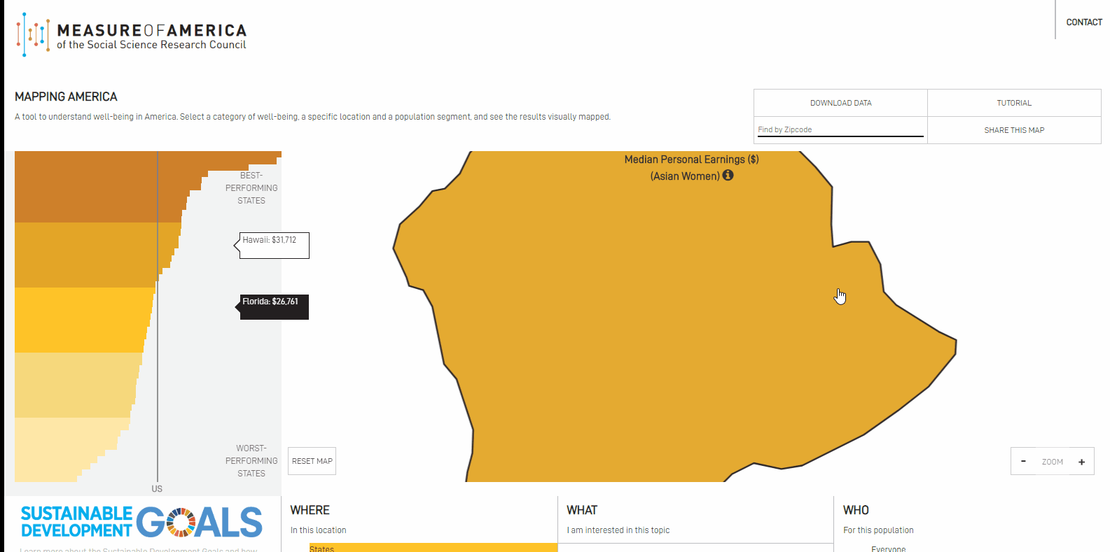
Project Background: With over 100 indicators, this program enables users to explore National Map data across four geographical levels (States, 25 most populous Metro Areas, Counties, and Congressional Districts).
My Role: Application development and coding.
Public Link: https://measureofamerica.org/maps/
Stack: HTML, .css, .js (leaflet.js, d3.js, jQuery)
Features:

Main View – Examine data across geographic levels that interactively correlate with histogram.

“Who, What, Where” Menu – View data across four geographic levels (Where). Select from more than 100 indicators (What). Sub-indicators reflect gender and race (Who).

Detail Module – Examine Well-Being Indices; Health, Education, and Income Statistics; Race & Ethnicity composition for selected geographic unit.
Albers USA to Web Mercator – (For the map geeks) transform from National view, projected as “Albers USA” to Web Mercator with tiled basemap. This feature enables users to explore choropleth map in the conventional National view – with Alaska and Hawaii presented below mainland USA. As user zooms toward regional scale, map will switch to Web Mercator for a conventional web map experience.